
The Oregon fire atlas
Find a place, inspect documented work and compare it with wildfire history. The guide explains how to interpret the boundaries, observations and treatment records you see here.
Loading source coverage…
One state. Many relationships with fire.
Start with the landscape. Then ask what fire changes—and what people want to protect.
Room for fire. Room for big trees.
In many dry pine forests, recurring surface fire helped maintain open stands. Fire exclusion can allow small trees and surface fuels to accumulate. The objective may be to restore a more open forest and reduce damaging fire effects.
What fuels have accumulated, and which trees should survive?
A treatment can change fire effects without preventing a wildfire. Weather, terrain, treatment age, and follow-up all matter.
Where did it reach?
A perimeter outlines a fire event. Some ground inside may not have burned.
What changed?
Severity describes effects such as vegetation change. One fire can leave a mosaic.
Was it beneficial?
That needs a local objective and evidence: habitat, surviving trees, community impacts, and recovery.
What actually happened here?
Objectives, observations, and the questions that remain. Every story has a source.
Two units. Two restoration goals.
In October 2025, OSU students burned two units with different objectives: releasing oak and madrone in one, supporting Willamette Valley ponderosa pine in the other.
Read OSU’s accountOSU College of Forestry · April 3, 2026Choose the objective
The account identifies the vegetation each unit was intended to support, rather than offering one generic reason for burning.
Release oak and madrone; support Willamette Valley ponderosa pine.
Burning and patchy effects described in OSU’s published account.
Verified unit boundaries, repeat vegetation measurements, costs, and comparable alternatives.
Regional context only. Burn-unit geometry has not been verified; we do not place a pin on these units.
The fire ends.
The landscape keeps changing.
Compare real, dated NASA imagery. Watch the burn scars appear, then look again five years later.
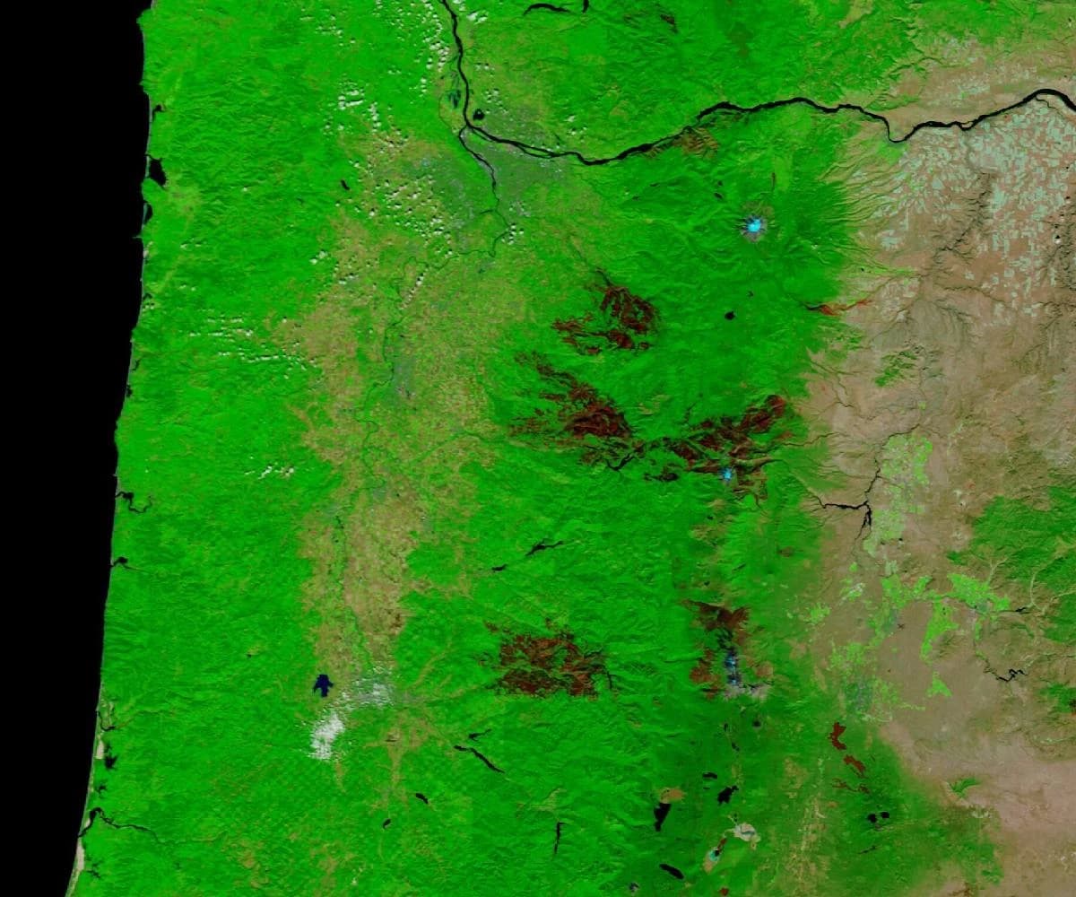
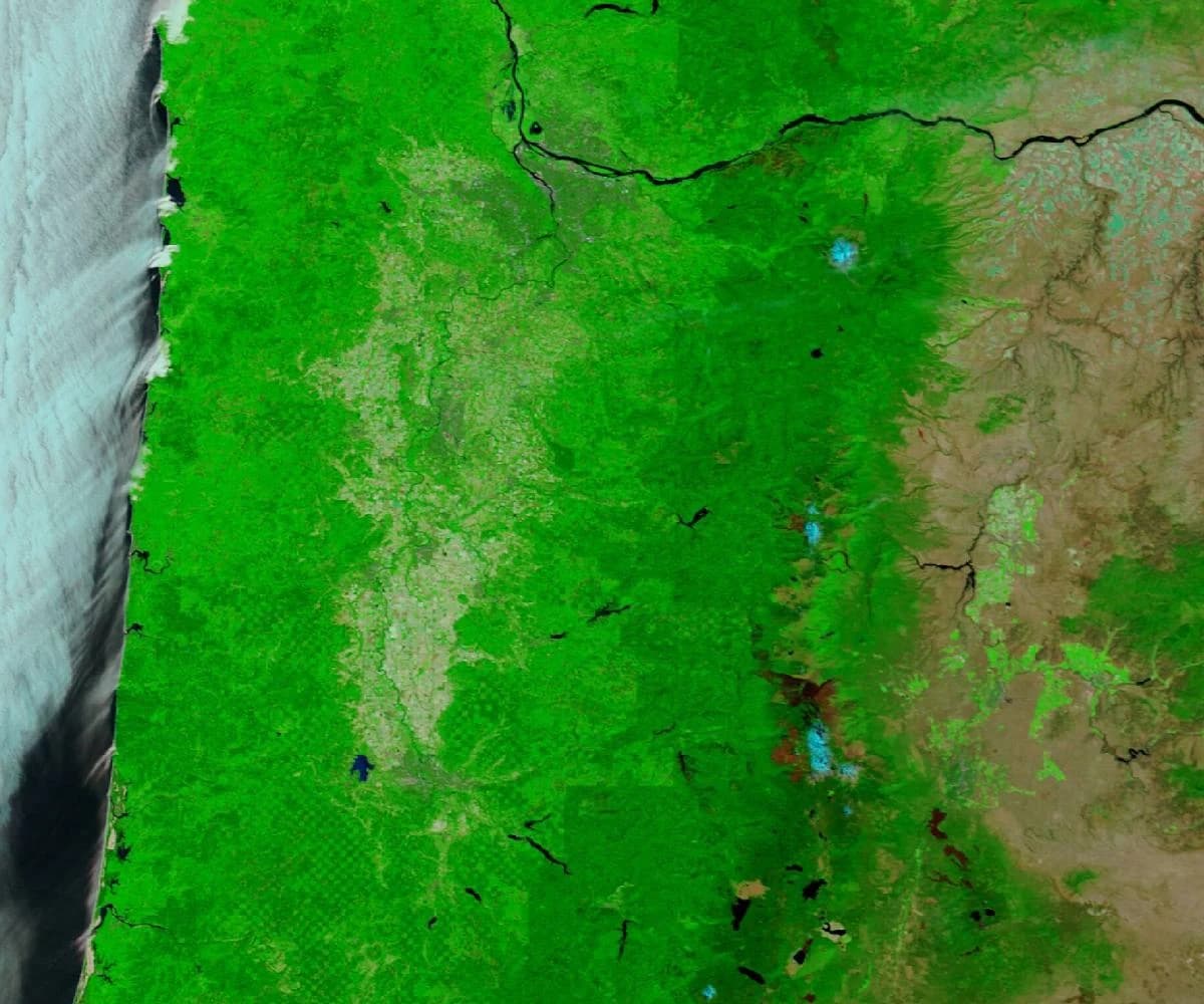
New scars interrupt the green.
NASA documented extensive new scars after the 2020 fires. Compare their shapes with the dated perimeter records, rather than assuming every dark area burned.
Why don’t we just burn more?
The right opportunity is a combination of conditions, preparation, people, and purpose.
Rain can open a window—or close it.
Changing moisture and weather can create opportunities before fuels become too wet. The Willamette Valley refuge program reports most burning in late summer or early fall.
Conditions must fit this particular plan.
Wind, humidity, temperature, and the forecast influence fire behavior. A seasonal opportunity is not an approval to burn. Conditions must continue to be monitored after ignition.
Choose the goal.
Then ask for the evidence.
“More acres burned” measures activity. Success depends on what a particular place and its communities need.
Is this forest better able to sustain its intended functions?
- Surviving trees, regeneration, and species composition
- Surface fuels and the need for repeat work
- Drought, later fire, and observations over several years
A returning vegetation signal is one measure. Tree structure, species, and fuels can follow different paths.
These options are not interchangeable or universally available. Decisions depend on ownership, policy, ecology, weather, and protection needs. A useful project review also names who decided, alternatives considered, costs, and public participation opportunities.
For each story above: an explicit objective, a documented observation, and the missing evidence. Costs and measured local outcomes are shown as missing when we have not obtained them. We have not calculated an Oregon-wide “good fire” percentage.
Smoke in your sky?
A fire near you is not automatically the source of your smoke. Use current official information alongside this historical atlas.
Understand smoke tradeoffs